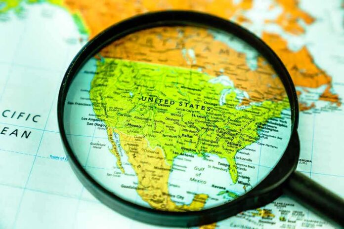
The United Nations just told the world to stop teaching a stretched map and start showing Earth at its true scale.
Story Snapshot
- The United Nations backed an equal-area world map by a 164–1 vote.
- Togo led the push for Africa, with support from the African Union.
- The resolution urges wider use in schools and public materials.
- The United States voted no, calling it ideological and a distraction.
What the United Nations Actually Voted For
The United Nations General Assembly adopted a nonbinding resolution that promotes equal-area world maps, especially the Equal Earth projection, to fix the way common maps distort the planet. The vote was 164 in favor, one against, and six abstentions. The text urges schools, publishers, and institutions to use projections that keep land areas accurate, rather than maps that inflate Europe and North America and shrink Africa and South America. The measure does not ban the Mercator map or compel nations to switch.
The resolution, led by Togo on behalf of African states and backed by the African Union, frames the shift as a correction to a long-running visual bias. Supporters say the Equal Earth projection is a relevant option to show continents at their real size on a flat page. They argue the Mercator projection misleads students about scale and status by blowing up high latitudes and squeezing the equator’s belt, where most people live.
Why Your Old Classroom Map Got It Wrong
The Mercator map was built for navigation, not fairness. It keeps angles true for sailors but explodes land area near the poles. That is why Greenland looks like it could swallow Africa when it is not even close. In reality, Africa is more than 30 million square kilometers and dwarfs Greenland, Europe, and the continental United States. On many wall maps, that basic fact vanishes in plain sight. Equal-area projections correct that by holding area constant across the map.
The Equal Earth projection keeps relative area right while offering a familiar, rounded shape that is easier on the eyes than some boxy equal-area designs. It does bend shapes more than Mercator, but it stops the silent trick our brains learn from stretched sizes. The International Cartographic Association factsheet also warns that Mercator should not be the default for world maps used in general display or education.
What Changes Now—and What Does Not
The vote is a signal, not a mandate. No country must tear down maps overnight. But the United Nations sent a strong message to schools, publishers, and media that it is time to retire Mercator as the go-to wall map. Textbook designers and software platforms now face pressure to shift defaults. United Nations agencies can update atlases, procurement templates, and teaching kits. If they do, that ripple can reach classrooms and newsrooms worldwide within a few years.
The UN General Assembly has voted to adopt a new world map projection that shows the size of Africa and other continents more accurately.
The “Correct The Map” resolution, sponsored by Togo and backed by African Union member states, received support from 164 countries. The… pic.twitter.com/tDuDLYWVtK
— Ⓝⓖ'ⓞⓡⓞⓡⓘⓔⓣ🐐🇰🇪 (@baroswahjr) September 5, 2026
Navigation remains a different story. Pilots and mariners still rely on projections that keep bearings and angles stable. That is what Mercator does best. The resolution leaves specialized uses alone and focuses on general learning, where scale matters most. The line is simple: use the right tool for the job. Equal Earth helps kids understand the world’s true proportions. Mercator helps ships track straight courses. Mixing them up creates confusion neither cartographers nor teachers want.
The United States Stands Alone—and Says Why
The United States cast the lone no vote and called the effort an ideological agenda that distracts the United Nations from real crises. The U.S. statement argued the General Assembly should not spend time on debates tied to sixteenth-century map designs and broader claims about reparations or “cognitive justice.” The U.S. said resolutions like this are barnacles on the institution’s work and hurt its credibility. That view puts process and focus over symbolism.
The U.S. case will appeal to readers who want the United Nations laser-focused on wars, borders, and budgets. But the core facts in the resolution track mainstream cartography. Equal-area maps do fix a known error that shapes public sense of scale. Common sense says both ideas can be true at once: guard the agenda against political creep, and still stop teaching a map that shrinks most of humanity’s home regions.
Why This Fight Matters Beyond the Wall Map
Maps teach power without saying a word. A child who sees a smaller Africa year after year learns a smaller Africa. That seeps into daily judgment about trade, aid, and security. Equal-area maps do not rewrite history, but they pull one quiet thumb off the scale. If publishers and platforms switch their defaults, the world that kids and voters picture in their heads gets closer to the truth. That is not ideology. That is accuracy with real-world effect.
Sources:
newscord.org, english.aawsat.com, en.wikipedia.org, ctvnews.ca
© integritytimes.com 2026. All rights reserved.